Open Data Platform for Agriculture & Environment
From fragmented data to actionable intelligence.
Data Pipelines
Standardised Ingestion Workflow
Analytics & APIs
Query + AI Processing Layer
Database Layer
PostgreSQL / PostGIS Compatible
Standardised pipelines • workflow automation • analytics APIs • PostgreSQL-compatible geospatial infrastructure
Agricultural data is fragmented - finally becoming unified 🚀
Agricultural data has historically been scattered across soil labs, machinery systems, GIS platforms, spreadsheets and field reports. We are building a unified data infrastructure layer for agriculture, environment and land systems.
Fragmented systems
Agricultural data is spread across machinery, labs, GIS systems and spreadsheets.
Unified data layer
Farms, fields, soil data and operations are connected into one structured platform.
From bureaucracy → automation
Reducing administrative overhead through standardized data flows and digital infrastructure.
Connecting ecosystems
Enabling collaboration between farmers, researchers and agricultural policy systems.
Connected agri infrastructure → for all stakeholders
Building the data layer for modern agriculture & environmental systems.
A modern operating layer for agricultural data
AlpsDataFarm transforms fragmented soil, laboratory and geospatial datasets into a unified intelligence system built for scalable analytics, automation and AI-driven agriculture.
Collect
Import soil samples, lab analytics, GIS layers and environmental datasets from distributed systems and field operations.
Unify
Standardize and structure fragmented agricultural data into one relational intelligence architecture.
Analyze
Generate live geospatial insights, AI-assisted analytics and decision intelligence through modern visualization layers.
Building the data infrastructure for next-generation agriculture
Designed for modern agricultural intelligence
A unified workspace for soil analytics, spatial infrastructure, environmental monitoring and operational intelligence.
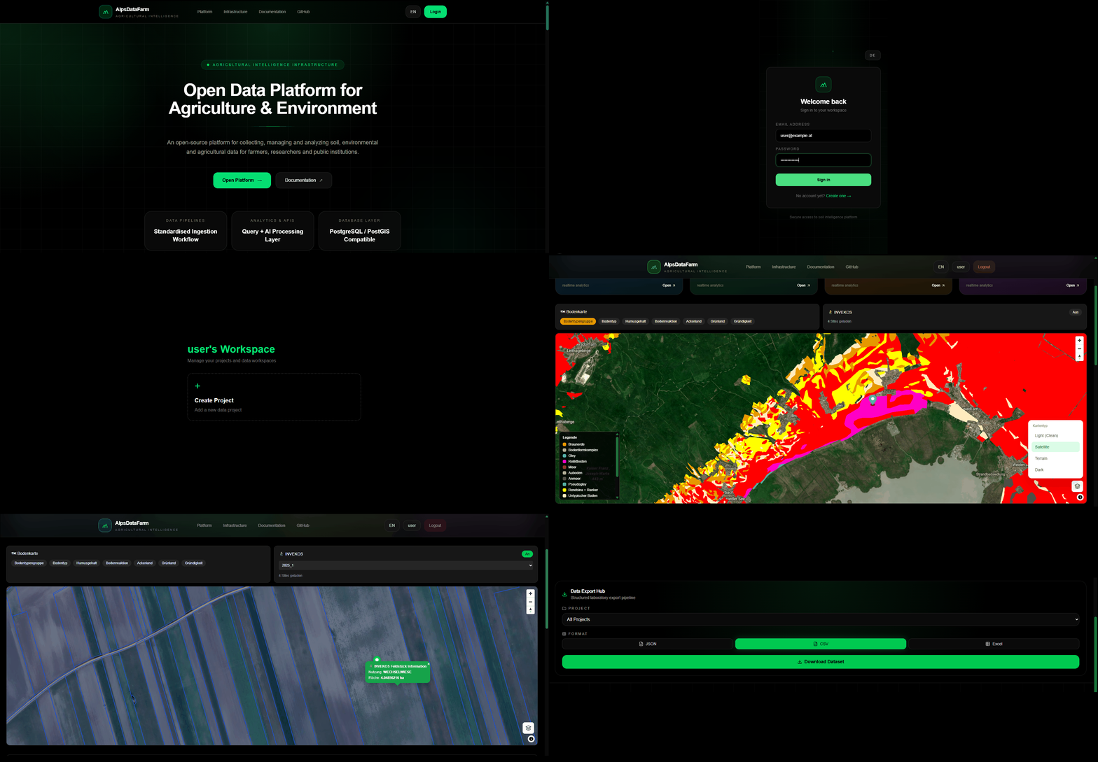
Infrastructure for connected agricultural data
AlpsDataFarm provides a standardized data layer for agriculture and environmental systems. Built for interoperability, collaboration and modern data workflows.
Geospatial Data Layer
Structured storage and visualization of soil, environmental and operational data through standardized geospatial formats.
Standardized Data Ingestion
Import lab results, field data, APIs and external sources into a unified structured data model.
Open API Architecture
Connect external tools, platforms and research systems through a consistent API layer.
Collaboration & Multi-Tenant Sharing
Secure data sharing between farms, institutions and researchers through multi-tenant structures.
Research Workflows (R / Python)
Run reproducible analysis workflows via API-connected R and Python environments for research and applied science.
Operational Data Distribution
Provide structured agricultural data access for farmers and institutions to reduce administrative overhead.
Built for interoperability, data standardization and connected agricultural systems
We are building an open data infrastructure for agriculture and environment.
Built as an open intelligence platform for agriculture, environmental science and geospatial collaboration — enabling a connected ecosystem across research, institutions and field operations.
Open Source Core
The platform is designed around an open architecture that promotes transparency, extensibility and community-driven innovation across agriculture and environmental technology.
Built for Collaboration
Connecting farmers, researchers, environmental scientists and institutions through shared intelligence infrastructure.
Vision
Building the digital infrastructure layer for next-generation agriculture.
Building digital infrastructure for connected agriculture
AlpsDataFarm connects farmers, laboratories, researchers, environmental institutions and public organizations through standardized geospatial infrastructure and shared agricultural intelligence.
Standardized Workflows
Unified agricultural and environmental data pipelines across laboratories, GIS systems and field operations.
Research Collaboration
Connecting science, agriculture and institutions through interoperable spatial data infrastructure.
Digital Administration
Reducing bureaucracy through connected systems, automation and modern analytics workflows.
Collaboration • Partnerships • Research
Interested in collaborating?
Whether you are a farmer, researcher, laboratory or institution — we would love to hear from you.
View Documentation